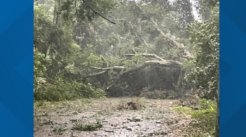

A quick-moving cold front and squall line will push through the area Tuesday afternoon, giving Northeast Florida and Southeast Georgia an enhanced threat for severe weather.
The isolated strong-to-severe storms will bring the threat of heavy downpours, tornadoes and small hail with the worst of the weather expected between noon and 7 p.m. Tuesday.
Heavy winds will move into the area after 10 a.m.
Several Northeast Florida and Southeast Georgia counties have canceled school on Tuesday because of the potential for severe weather.
📲 Stay up-to-date with severe storms and weather news by downloading the News4JAX Weather apps
Here’s what to expect:
Tuesday Winds
-
Sustained winds: 20-35 mph
-
Gusts: 40-50 mph
MORE: What the wind means for area bridges
Gale conditions throughout local waters through Tuesday night.
Minor Coastal/Tidal Flooding on Tuesday
The main threat areas are the St. Johns River Basin around Downtown Jacksonville and coastal SE Georgia.
With the fast-moving system, widespread rainfall flooding is not expected, but some localized flooding is possible.
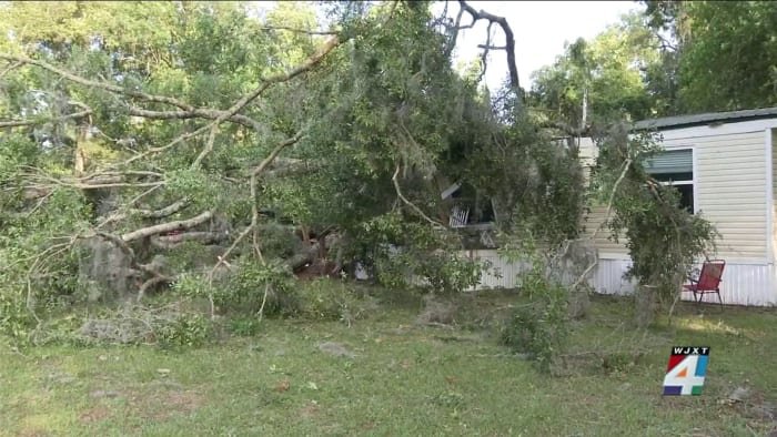
Tree damage and power outages are possible — secure your patio furniture/trash cans, etc.
There is a High Rip Current Risk & High Surf Advisory for all local beaches Tuesday.
Timeline of Arrival
Noon to 2 p.m. Tuesday
Arrives in Waycross, Homerville, Jesup and Lake City.
2 p.m. to 5 p.m. Tuesday
Arrives in Brunswick, Fernandina Beach, Jacksonville and Gainesville.
5 p.m. to 7 p.m.
Arrives in St. Augustine and Palm Coast.
Conditions and severity could change, so it is important to be aware of potentially severe weather throughout most of the day tomorrow.
Download our News4JAX apps to get the latest news and weather alerts during the storm.
Weather on SnapJAX
Be sure to safely upload your weather photos and videos on SnapJAX to let our meteorologists know about flooding, hail, strong winds and more.
Copyright 2024 by WJXT News4JAX – All rights reserved.