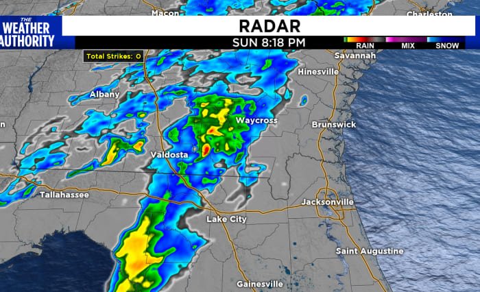
The rain is starting to move into SE Georgia and north Baker County in NE Florida. The severity of the storms seems to have lost some steam once the sun set, but can’t rule out thunderstorm activity, heavy downpours, and gusty winds that have been associated with this frontal system.
Our southern counties will see rain over the next few hours with a chance of isolated storms through the morning hours. Temperatures start out in the low 60s and only move to the low 70s by mid-afternoon. With clearing skies, temperatures will continue to fall overnight into Tuesday, which is the first day of Spring. Look for lows in SE Georgia in the upper 30s and lower 40s in NE Florida. Wednesday looks picture perfect under blue skies and seasonal temperatures. Next chance for rain is Friday.
Copyright 2024 by WJXT News4JAX – All rights reserved.


