

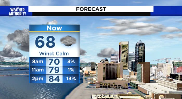
This morning patchy to dense fog is possible mostly inland. Squeezing in the last “summer-like” morning before the cold front moves through with lows in the upper 60s to 70s this morning.
Later on today, partly cloudy skies with highs in the upper 80s and winds from the west between 5-10 MPH.
Low rain chances across our southern counties mostly after 4 PM.
Tonight: Cold front moves through dropping temperatures with winds from the N between 5-10 MPH. Overnight lows will drop into the mid to upper 50s region wide with some locations possibly dropping into the 40s mostly inland.
Sunday: Partly cloudy to mostly sunny skies with highs in the mid to upper 70s with much drier air 😊
Rest of the week: minimal rain chances with temperatures climbing back into the 80s by the midweek and rain chances return by the end of next week.
Sunrise: 7:23 AM
Sunset: 7:04 PM
Copyright 2023 by WJXT News4JAX – All rights reserved.