

Meteorologist Lauren Rautenkranz urges folks to stay tuned for updates as the timing of this weekend’s rain in Jacksonville is still uncertain.
JACKSONVILLE, Fla. — Open up any weather app on your smartphone this week and you’ll see a high chance of rain and wind this weekend in Jacksonville. But there’s more to the story than what meets the eye.
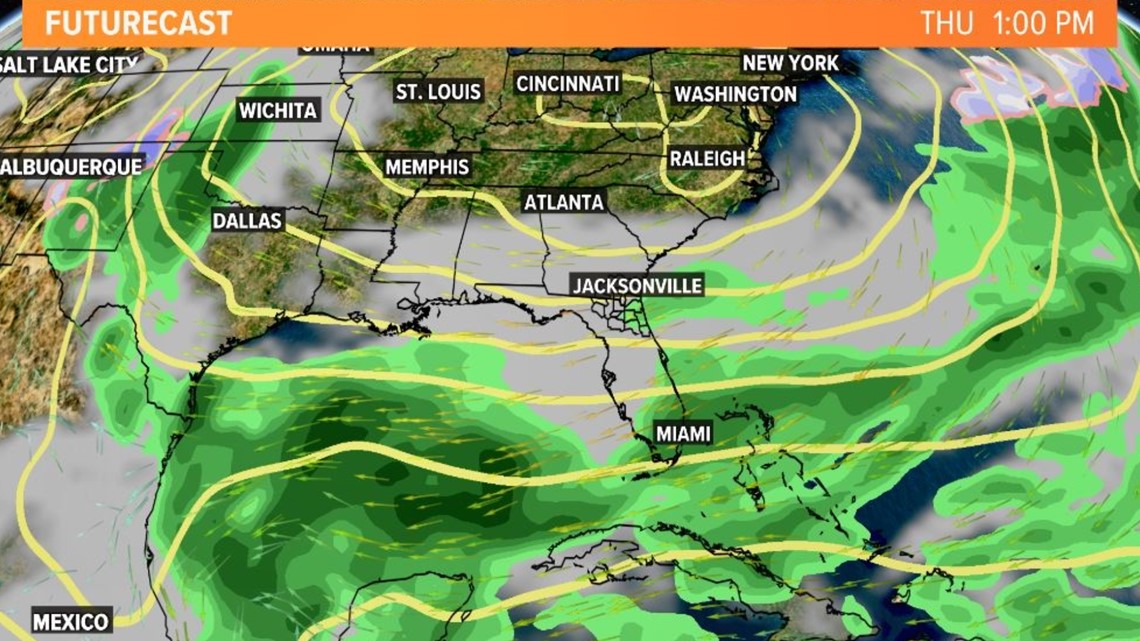
For starters, the timing and location of the heaviest rain in the next week across the Sunshine State is still uncertain. Two of our most reliable computer models, the GFS and Euro, haven’t lined up with 1) where an area of low pressure will track over Florida from the Gulf of Mexico and 2) when the most consistent batch of downpours blows in.
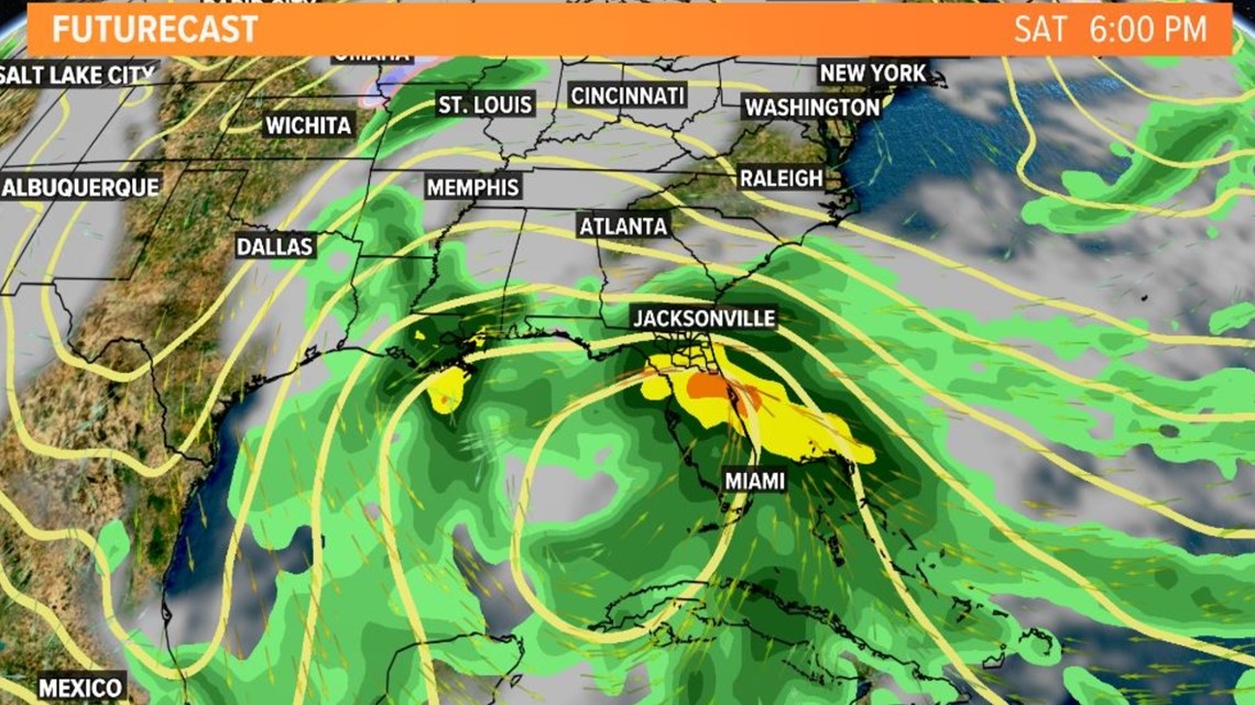
The GFS has trended toward a wet Saturday night with lighter showers through the day on Sunday. The Euro has Sunday highlighted for the soaker of the weekend but has kept the heaviest rain for the region just to the south of the River City.
Either way, the meteorological setup includes pieces of energy headed our way, cutoff from the northern and southern branches of the jet stream late this week and into the weekend. Cyclogenesis occurs across the Gulf of Mexico resulting in an area of low pressure moving across Florida beginning Saturday.
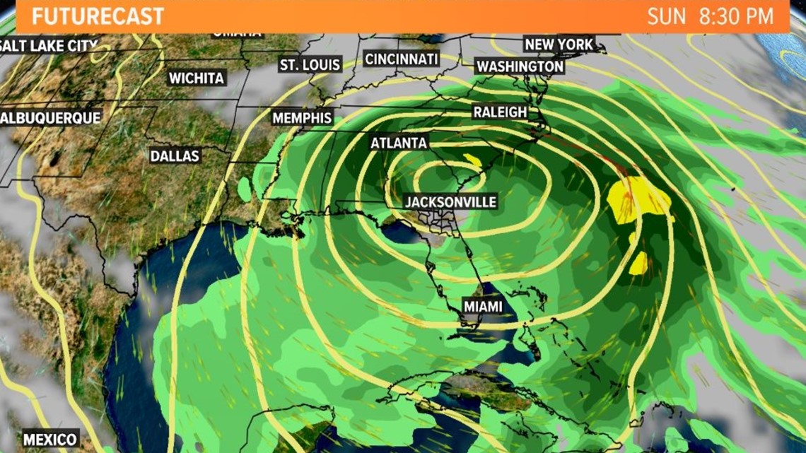
Bottom line: A strengthening high-pressure system this week kickstarts our breezy onshore flow, but it will persist into the weekend. That is why Jacksonville’s Most Accurate Weather Team at First Coast News is calling for a major nor’easter to develop Tuesday afternoon and last through the weekend.
Isentropic lift and overrunning will increase rain chances from south to north. The rain will likely become heavy at times, but the rain turns lighter as the weekend goes on and showers should weaken by Sunday evening or early Monday, with a drier air mass advecting into the region thereafter. Forecast confidence in rainfall amounts remains low at this time given the inconsistency in computer guidance from run to run. Clouds will be thicker with lows in the mid-50s and highs in the upper 60s.
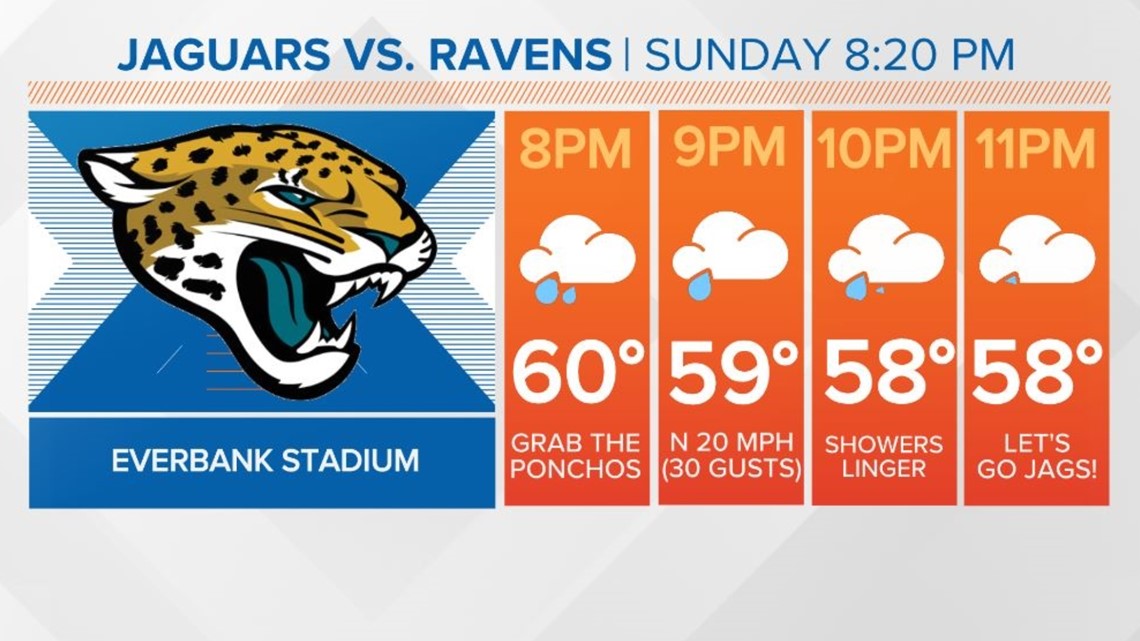
So… STAY TUNED TO UPDATES! The forecast will continue to be fine-tuned and we will eventually be able to give you a better timeframe of when the heaviest rain will arrive and how it’s shaping up for the Jaguars primetime matchup in Jacksonville.